Date: June 7, 2014
Location: Phoenix AZ
Hikers: Me & Tina
Directions:
Take Central Ave from North Phoenix or Central from I10 or I17. Head South on Central Ave until the road turns into the South Mountain Park. Take the road to the left up to the Buena Vista Lookout. It is 6.5 miles up the hill from the main entrance. Follow the signs to the summit and look for Buena Vista Lookout. Restrooms at the bottom and Water/Vending Machines.
South Mountain - Trails
Complete overview:
http://phoenix.gov/webcms/groups/internet/@inter/@rec/@parks/@parks/@nrd/documents/web_content/southdetailed.pdf


We are hiking from the Buena Vista Lookout today. The trailhead parking is a dead end up the street from the entrance. It takes a while to get up there so factor that in to your hike. We planned to start at 5:30 AM due to the heat. We left North Phoenix at 5:00 and by the time we made it to the top of the hill our hike was starting at 6:00 AM (We took a One way and hit a bird on the way...slowed us down)
Our loop is to the West of the parking lot. The East side is the Corona de Loma - START and the West side will be what we come out on at the end. National. Fingers Crossed!
The plan today is a 10 miler.
Corona de Loma (South) 2.2 miles
Desert Classic (East to West) 3.4 miles
Telegraph Pass (North) .8 Miles
National 3.4 (West to East)
 If you look at the map this will be a loop. There are a lot of bikers that use the South Mountain trails, Be Warned! The only part of South Mountain I have hiked is the East side by the Pointe South Mountain. I am already surprised by the drive up the hill.
South Mountain is the most noticeable mountain in Phoenix. It is the one with all the towers on the summit. South Mountain and Camelback fight over which is higher. They say Camelback is by a few feet. Although South Mountain has the most drivable point in the Valley. The elevation is 2700 feet. The American Indians call the mountain Mount Suppoa. There are ancient petroglyphs through out the mountain. There are ruins from the American Indians and settlers on various trails.

 We took off right at 6:00 AM. The temp was a manageable 80 degrees. The sun was up and we were walking into the sun but is was not bad. The terrain at the bottom of Corona de Loma is very sandy. There were three stops to clean out rocks in our boots. With a 10 mile hike ahead it is stupid to keep rocks in your shoes. The only thing that = is blisters.
The terrain was rocky similar to Lookout once we started up the hill. Without Saguaros.
We only saw two people on this trail. One running down and one hiking up. The views of the South and East were beautiful. Very different from our usual scenery.


 I had my notes and map with me with the mile markers. A 10 miler in the heat is not one you want to add mileage too on a June morning.
We hit the bottom of Corona de Loma. I had read about a lone cactus and not to take a right. So we went Left. (East) The pole markers are typical of Phoenix. aka Missing the details on the pole.
This is where we started to hit the bikers. Most were nice. That does not always happen. We wrapped around and then started heading to the West where we met up with the Desert Classic trail.

My GPS was at 2.8 vs 2.2 but I did not think much about it. Close enough.

 The hike on Desert Classic is flat with a couple easy up and downs. Lots of bikers. More people. We saw a different junction to Corona de Loma. Hmmmm and there was the hiker coming down that we saw going up. Didn't think much of it at the time but now I know that we hit Desert Classic higher than planned and did about a mile more than expected. The dog whisper (Tina) saw a dog again we passed before. She travels with treats so dogs like her.

 We chatted along the 3.4 miles with the sun at our back. We tried some of our energy gummy that we will eat on our hike. Tina was testing them out. The lemonaide ones are very good. Would have been better cold.

 We can look to the North and see the towers. We need to travel a distance to the West to get between the mountains and get back up to the top by the towers. Piece of cake.
We see more people on this trail. Most people came from parking areas on the South side of the mountain.
You can tell we are at the bottom because the vegetation has changed.


We headed toward Telegraph Pass as we passed along the side of a housing development. I had google mapped our travel before with a satellite view so this is what I expected.

 We had gone along the south of the towers and there was a pass between the mountains that looked like we would head back up to the top. This would be the Telegraph Pass trail.
The neighborhood must have put in these signs. They are much nicer than the city markers. Ahwatukee are the rich folks! HA HA
Now it is time to head up. It is approx 1 mile up to the Saddle where we will now see the North and South Views. There are a lot of people up on the trail. We can see them from the bottom.

There are numbers on top of the city markers but we never did figure out why or what they are for. I will research that if we come back in the future. Our numbers that we are following have now drastically changed. This is our view up and down as we start up Telegraph Pass.

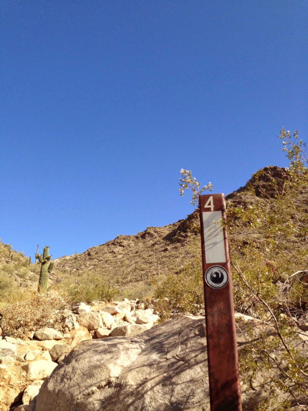
Similar to North Mountain but longer it was short switchbacks that got your heart racing. After traveling 7 miles we were feeling it. This trail had a lot of people on it. We passed a Dad with a little boy about 10 crying on the way down. No fun. Then we passes a kid with his Grandfather and dog. The kid was hiking in flip flops. The cheap kind. Dumb Ass!


We made it to the top and sat on a bench. We chatted with a guy that said from bottom to top was 29 minutes. Yeah...that is how fast we did it. He told us about the National Trail that is 14.3 miles that travels on the top of the mountain.


We will be taking National back to the East to get to the car. He said "Oh yea it is flat". LIAR!!


We sat for a minute and I was supposed to empty the sand from my shoe. FORGOT. We headed up National towards the towers.
The view was amazing to the North. We saw all of our mountains.
We started up the hill of the National trail. This is our final trail and I anticipate we have about 3 left.
As we head east we hike along the mountain and could see the road to the towers. We slowly realized that we were going up to the towers. I kept telling Tina, No we aren't. :) WRONG.


The bikers ride down the street at fast speeds. Pretty cool. Not for me though. We see the National trail marker so we know we are still on the right trail.
I now knew we had about 3 miles left because we basically had to travel the same distance along the top as we did on the bottom. It started to feel long. The trail headed up and East.


Amazing views to the North. I wish the pollution was not there. You can see a fire to the North too.


We lost sight of the road. I started looking at my GPS and could see that the Gap was a good distance from where we were to the car. I started showing Tina with my fingers how much the Gap was. The Gap turned into the Cairn joke from the Wave Cave hike.
We used an adjective when describing "The Gap". We passed one person. Funny no one else is out here. I guess I tend to find off the beaten path hikes for a lovely June morning. We the started seeing the road again as the Gap closed. We crossed the street to stay on the National Trail.

 We passed two bikers and could see two people in the distance. With water running low and us at 11 miles we were about done. Our GAP was getting smaller!!
Rounding the corner. I don't think we could enjoy the beautiful rock formation because we just wanted to be done. Suddenly we look ahead. There is the parking lot!!

We went further than expected. I think the wrong turn at the lone cactus was why. But it was ok. We did good time. We were both ready for a nice cold QT Arnold Palmer. We talked about that for the last two miles.


South Mountain - Trails
Complete overview:
http://phoenix.gov/webcms/groups/internet/@inter/@rec/@parks/@parks/@nrd/documents/web_content/southdetailed.pdf
We are hiking from the Buena Vista Lookout today. The trailhead parking is a dead end up the street from the entrance. It takes a while to get up there so factor that in to your hike. We planned to start at 5:30 AM due to the heat. We left North Phoenix at 5:00 and by the time we made it to the top of the hill our hike was starting at 6:00 AM (We took a One way and hit a bird on the way...slowed us down)
Our loop is to the West of the parking lot. The East side is the Corona de Loma - START and the West side will be what we come out on at the end. National. Fingers Crossed!
The plan today is a 10 miler.
Corona de Loma (South) 2.2 miles
Desert Classic (East to West) 3.4 miles
Telegraph Pass (North) .8 Miles
National 3.4 (West to East)
South Mountain is the most noticeable mountain in Phoenix. It is the one with all the towers on the summit. South Mountain and Camelback fight over which is higher. They say Camelback is by a few feet. Although South Mountain has the most drivable point in the Valley. The elevation is 2700 feet. The American Indians call the mountain Mount Suppoa. There are ancient petroglyphs through out the mountain. There are ruins from the American Indians and settlers on various trails.
We took off right at 6:00 AM. The temp was a manageable 80 degrees. The sun was up and we were walking into the sun but is was not bad. The terrain at the bottom of Corona de Loma is very sandy. There were three stops to clean out rocks in our boots. With a 10 mile hike ahead it is stupid to keep rocks in your shoes. The only thing that = is blisters. The terrain was rocky similar to Lookout once we started up the hill. Without Saguaros.
We only saw two people on this trail. One running down and one hiking up. The views of the South and East were beautiful. Very different from our usual scenery.
I had my notes and map with me with the mile markers. A 10 miler in the heat is not one you want to add mileage too on a June morning. We hit the bottom of Corona de Loma. I had read about a lone cactus and not to take a right. So we went Left. (East) The pole markers are typical of Phoenix. aka Missing the details on the pole.
This is where we started to hit the bikers. Most were nice. That does not always happen. We wrapped around and then started heading to the West where we met up with the Desert Classic trail.
My GPS was at 2.8 vs 2.2 but I did not think much about it. Close enough.
The hike on Desert Classic is flat with a couple easy up and downs. Lots of bikers. More people. We saw a different junction to Corona de Loma. Hmmmm and there was the hiker coming down that we saw going up. Didn't think much of it at the time but now I know that we hit Desert Classic higher than planned and did about a mile more than expected. The dog whisper (Tina) saw a dog again we passed before. She travels with treats so dogs like her. We chatted along the 3.4 miles with the sun at our back. We tried some of our energy gummy that we will eat on our hike. Tina was testing them out. The lemonaide ones are very good. Would have been better cold. We can look to the North and see the towers. We need to travel a distance to the West to get between the mountains and get back up to the top by the towers. Piece of cake. We see more people on this trail. Most people came from parking areas on the South side of the mountain.
You can tell we are at the bottom because the vegetation has changed.
We headed toward Telegraph Pass as we passed along the side of a housing development. I had google mapped our travel before with a satellite view so this is what I expected.
We had gone along the south of the towers and there was a pass between the mountains that looked like we would head back up to the top. This would be the Telegraph Pass trail.The neighborhood must have put in these signs. They are much nicer than the city markers. Ahwatukee are the rich folks! HA HA
Similar to North Mountain but longer it was short switchbacks that got your heart racing. After traveling 7 miles we were feeling it. This trail had a lot of people on it. We passed a Dad with a little boy about 10 crying on the way down. No fun. Then we passes a kid with his Grandfather and dog. The kid was hiking in flip flops. The cheap kind. Dumb Ass!
We made it to the top and sat on a bench. We chatted with a guy that said from bottom to top was 29 minutes. Yeah...that is how fast we did it. He told us about the National Trail that is 14.3 miles that travels on the top of the mountain.
We will be taking National back to the East to get to the car. He said "Oh yea it is flat". LIAR!!
We sat for a minute and I was supposed to empty the sand from my shoe. FORGOT. We headed up National towards the towers.
The view was amazing to the North. We saw all of our mountains.
We started up the hill of the National trail. This is our final trail and I anticipate we have about 3 left.
As we head east we hike along the mountain and could see the road to the towers. We slowly realized that we were going up to the towers. I kept telling Tina, No we aren't. :) WRONG.
 |
| I think she said I love going up hill! |
The bikers ride down the street at fast speeds. Pretty cool. Not for me though. We see the National trail marker so we know we are still on the right trail.
I now knew we had about 3 miles left because we basically had to travel the same distance along the top as we did on the bottom. It started to feel long. The trail headed up and East.
Amazing views to the North. I wish the pollution was not there. You can see a fire to the North too.
We lost sight of the road. I started looking at my GPS and could see that the Gap was a good distance from where we were to the car. I started showing Tina with my fingers how much the Gap was. The Gap turned into the Cairn joke from the Wave Cave hike.
We used an adjective when describing "The Gap". We passed one person. Funny no one else is out here. I guess I tend to find off the beaten path hikes for a lovely June morning. We the started seeing the road again as the Gap closed. We crossed the street to stay on the National Trail.
 |
| Crossing the road to the National Trail, cont. |
We passed two bikers and could see two people in the distance. With water running low and us at 11 miles we were about done. Our GAP was getting smaller!!Rounding the corner. I don't think we could enjoy the beautiful rock formation because we just wanted to be done. Suddenly we look ahead. There is the parking lot!!
The car appeared. (CHEERING) We made it.
We went further than expected. I think the wrong turn at the lone cactus was why. But it was ok. We did good time. We were both ready for a nice cold QT Arnold Palmer. We talked about that for the last two miles.
As I got in the car I was shocked back into reality that I don't own the mountain. A bee sat on my already swollen hand and stung me. There the stinger stuck out as a swatted him off. ZING!
Maybe the birds and the bees are in cahoots. I did hit a bird on the drive to the hike.
It was a great hike.
Recommendation don't hike after 10:00 am. HOT!
A long one for sure. More strenuous than planned.
We will definitely come back to South Mountain. Lots more trails to travel.
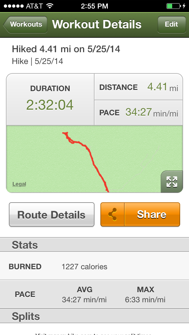
We went 11.14 miles in 3 1/2 hours. We gained 1476 feet in elevation.
10 left + Grand Canyon!
Hike #39 Done! Check it Off!