Hike #6
Date: November 16, 2013 (Birthday shout-out to Steve, Michelle & Jerry)
Location: Scottsdale AZ
Hikers: Linda & Jim
Directions: From Scottsdale Rd or Pima Rd, turn East onto Happy Valley Rd. Proceed about 2 miles past Alma School and turn right (East) onto Ranch Gate. Proceed to the end of Ranch Gate and then turn right (South) onto 128 St and you'll arrive at the trailhead in less than a mile. Restrooms available. NO Water.
http://www.mcdowellsonoran.org/trailhead/displayLocation/8#sthash.LxrqDYkh.dpuf
In my quest to continue to find NEW hikes I decided to turn an old favorite into a new adventure. Toms Thumb is a great trail. It is a steep incline and now that there is an official trailhead the trail is highly used and erosion is occurring. Be careful!
On the drive to meet Jim at 7 am. I felt like I was driving in Hawaii. (I have never been to Hawaii so it is just a guess). The clouds were low over the McDowell Mountains as the sun tried to rise. However the rainy overcast sky looked very eerie. I love this weather!! Feels like home! The plan for today is an 11 mile hike. It's gonna be a GOOD one! The little thimble sticking up is Toms Thumb. Looks so close. NOT!
 |
| Tom's Thumb Trailhead North Side |
Jim reminded me not to leave valuables in the car. There have been a lot of break-ins at this parking lot. Of course I threw my purse in the trunk. Probably should stop doing that.
 |
| Options! |


We did not see anyone on the trail as we headed up. It is always nice to hike early because there are few people.
The View down the East End Trail was awesome. On a clear day you can see the fountain in Fountain Hills. It shoots off water every 15 minutes from 9 to 9. Check out some info on the Fountain. It is the 4th Tallest in the WORLD!
http://en.wikipedia.org/wiki/Fountain_Hills,_Arizona
We saw two guys coming off the side trail of the East End. We asked if we were going the right way because there are two trails next to each other. They said Yeah. The one on the left was to a cave. They had camped out in a Cave over night. They said it was "that a way" and they probably could never find it again. I am not interested in getting lost. To be young again!
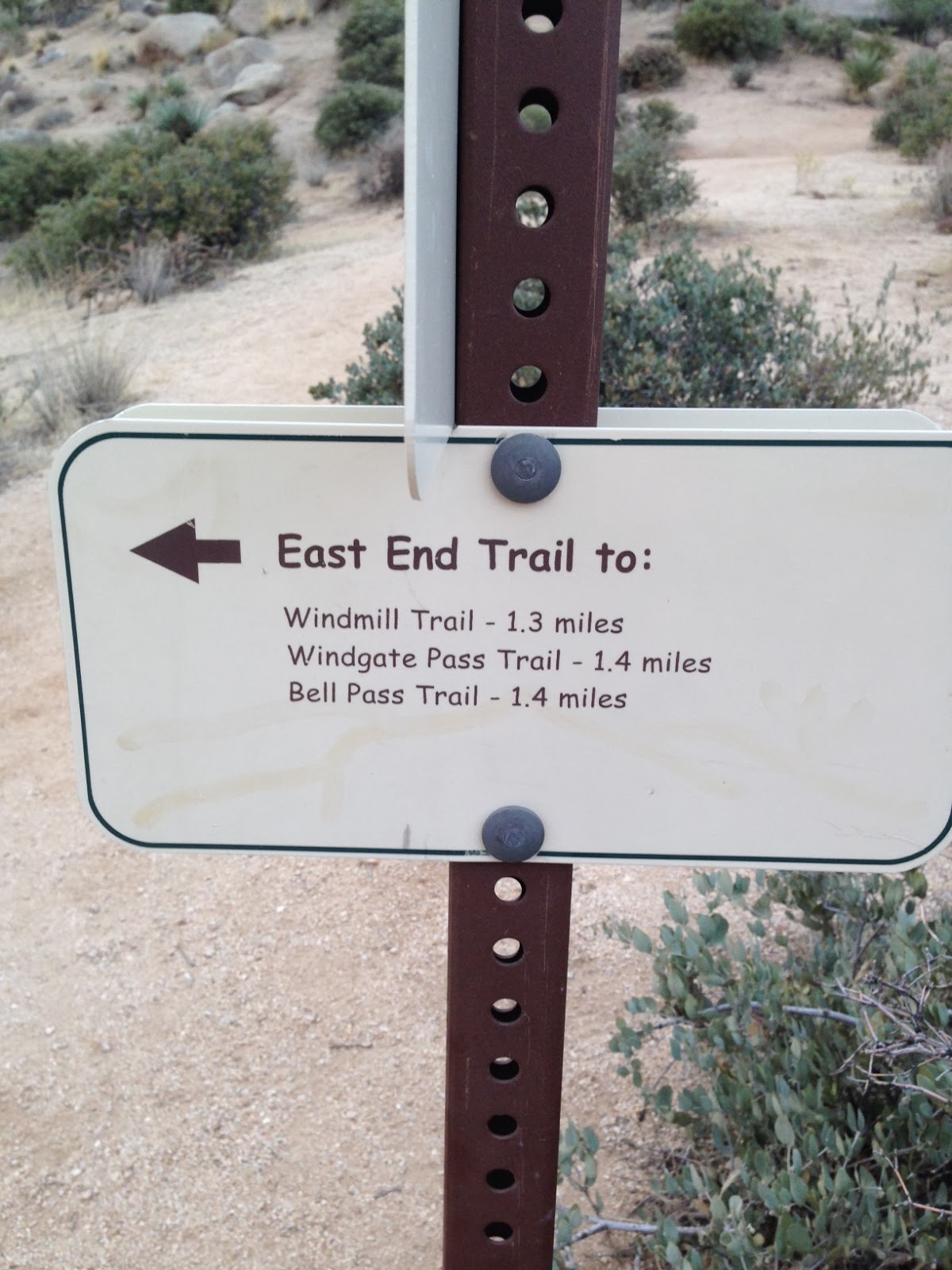

The trail down the East End was very different. The dirt was more like red clay and the trail was steep. We knew that we would have to travel 1.3 miles to pick up the Windgate Pass Trail. We had hiked Windgate before. Years ago when we were training for a Grand Canyon hike. It looks like a pasture in Kansas. Strange when you just came from Clay and Rocks.

 We continued to hike but could see to our north west that the sky was pitch black. That was the direction we would be heading to soon. Jim is lagging behind because there was a tree that he needed to check out! :) We hit Windgate and finally saw someone. There was a runner by himself. We took a right and headed West on Windgate. I did not remember it being a slow uphill climb. But it was! We had been hiking for 2 hours. We saw a Mountain biker go by at this point. We started talking about food. Our favorite subject. We knew this would be a long hike so we brought snacks. Jim was yaking about a Cheese Sandwich that sounded Boring! I of course forgot my sandwich. HA! But had almonds, Grapes and an apple. Good mix of Carbs and Protein. We decided we would stop at the exact Windgate Pass location between the mountains.
 The mountain on the right is what we just went around to the East. Now we will travel West to then hike up the North side to get back to Toms Thumb. It was a little windy but time to make a stop and eat. The sky looked bad but no rain and as we continued West the sky broke up. No Worries.
As we headed West to pick Tom's Thumb trail we met up with a lady. She was lost. She was with a group and she took a break, she saw them on the "other side" and thought she was heading in that direction. Ahhhh. No! She was probably a mile past the turn she should of taken to do a 5 mile loop. She was heading for a 10 mile loop. We turned her around and eventually in the distance she could see her friends. NOTE: Don't hike alone or separate from your group. Especially if you are on a long trail that you have never done. Short intown hikes are fine alone, but not in the McDowells. We pointed her in the right direction and hooked our right to head up 3 miles to Toms Thumb.


Up we went. If you think this was an easy 11 miles, don't kid yourself. It was tough even for someone that hikes alot. The inclines up and down do a number on your knees. Poles definitely help on this hike. It was windy as we hiked higher. We stopped for a quick apple break. We had been hiking for about 4 hours when we hit the top of Toms Thumb. There were tons of people by now. Tourists!! We met up with an Oregon State fan visiting. Poor Beavers lost to The Sun Devils. Fear the Fork! (post hike information).
It was a great day. We finished the 11 miles in about 4 hours 45 minutes with a few stops and some lunch. Another fun day with Jim Croutch. I can only hope that I have his energy when I am 65!! He is Amazing!

My Mapmyhike did not record properly. Thanks to my IOS upgrade I had the GPS off when the screen saver was on so it thought we went in a straight line for a while and did not record. Oh Well. *Notes for this hike. Bring your Camelbak full. Cool days are no problem, if it was hot we would have needed an extra container hooked on. Snack are a must. Don't leave your PB&J at home!
Number 6 Done - Check it off!
