Make your way to Highway 60. Take it East towards Apache Junction. Travel 7.6 miles East of the junction Idaho Rd/US-60. Turn left on to FS77 which is Peralta Road. Follow FS77 5.6 miles to a left and up turnoff. Continue 0.6 miles to Carney Springs Trailhead. No Water and No Restrooms.
Carney Springs Trailhead:
http://www.superstitionwildernesstrails.com/maps.html
Wave Cave in the distance and a cloudy start to the adventure.
Let me start by saying, I hate failure. Eleanor Roosevelt said "Do one thing everyday that scares you.". I do not particularly like the unknown. If you know me I plan the heck out of everything. This 50 new hikes challenges me more than just physically. I research everything before I go on a hike. Sometimes it works, sometimes it doesn't. I think this 50 hikes is teaching me a lesson.
The goal for this hike was to find "The Wave Cave". You do not see trip reports on this hike very often. You also don't find good maps. But if you see some people's pictures you know that this would be an awesome shot to have on your Facebook page. With my handy dandy photographer along for this pre-Easter hike we were ready to bushwhack!!
Note: This is not "the Cave" in the Superstitions or "the Wave" in Northern AZ. You want an adventure google "The Wave Arizona". That is on my bucket list for 2015.


The Peralta Road is poorly marked. We did drive down to the Peralta trailhead which I knew if we hit we went too far. We went back to the parking area that I thought was correct. We passed many cows on the road while driving. You do not know if you are at the Carney Springs Trailhead. There is no sign. There was only one car in the parking lot. It felt like the right place based on the reviews I read.


Julio and I started out on the trail. We passed one lady that told us there was a cow and it's calf under the tree. We asked the woman if this was the way to the Wave Cave. She said yes, she had just been up there and pointed straight up the hill. We could see it too.
The wildflowers were out in bloom. Still not full force but getting there. I think there was a cow behind that tree and we did not know it. Well the Cow saw us as soon as Julio decided to get too close taking a picture. Let's just say there is no picture to share and Julio is a really fast runner!!
We headed up to a gate that I had read you needed to cross to get into the superstition wilderness area. I was looking for Cairns that I read marked the path. This is where I miss read. The obvious Cairns were for the Carney Springs trailhead the rocks blocking the path as in
don't go there" was were I should have been looking.


WRONG. So we went straight. With the Wave Cave in our sights we thought at some point we would be wrapping around a trail to the left. That never happened. We lost sight of the Wave Cave but still thought we were heading in the right directions. There were a few spots that the trail was sparse. We went off trail bushwhacking and realized we were wrong.
We got back on the trail and that is when I trusted my gut and knew we were not headed to the Wave Cave.
We were on Carney Springs. You could see the place in the rocks that there would be a waterfall. It was still a beautiful overcast day so we decided to keep hiking. We made it to the end of the trail and decided to turn around and head back. The hike was really cool even though we did not make it to the intended spot!!
This balanced rock was huge. We walked up to it and still talked about how off we were. Guess we were not balanced today!
Still thinking the Wave Cave was in our reach. We still had not seen anyone on the trail since the cow warning lady.
I re-read my notes I had printed. I felt if we went back to the fence we could figure out the right way. We made it back. We made it back down to the gate and decided to go to the East along the gate. Will we be correct? Keep reading.....

Still had enough water and at the spot where we crossed the wilderness we headed to the West along the fence. We walked along the trail and a snake was crossing the path. It is that time of the season and today was perfect snake weather. I did my usually scream and hopped over him as quick as possible.

There was a spot where we crossed a gate. There were a lot of saguaros along this trail and we had the Wave Cave in our sites.
But this still did not feel right. We were heading too far West. But we tried it. It did not take long for us to realize we were not heading towards the cave. We were heading away from it again. GRRRR.
 |
| Blooming Cactus |
So we headed back to the original gate. The whole way I was on snake lookout. We finally passed two hikers. They were not going in the same direction so we did not talk to them. We could see the wave cave coming back into sight so we now that I was wrong again.
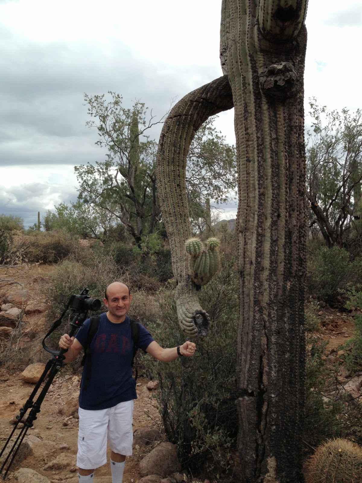
I read a lot of trip reports and hiking blogs. Someone mentioned that Saguaros with downward arms are lucky and give off good energy or have Vortex. They are rare and when you start looking around you do realize most are pointing up. We found this one and I told Julio to stand under to feel the energy......hmmmmmm Nothing! :) I will keep looking for them because is it kinda fun now.
We went back to the gate and that is where I read the trail notes AGAIN. It talked about the rocks marking the trail that made it look like you should not cross them. BINGO that was it. If you looked far up the trail there were Cairns. So we start again!!

 |
| Peace Sign Cactus |
The trail was a lot more bushwhacking and you had to keep your key on the Cairns. The tough part was they were EVERYWHERE so I started second guessing myself. We headed UP as we usually do. We could see the Wave Cave so at this point I knew we were in the right place.
Well, I started realizing we were going too far up on the East side of the Wash. The notes talked about crossing the Wash to get to the cave. I looked down and saw Cairns. UGH!
Although we had been following Cairns up the whole way. We were on the other side of the wash. It would be very difficult to go down to get to the Cave from where we were. To continue up was taking us to a different spot.
That is when my gut said. WE ARE DONE. We were limited on water. Julio forgot his cell in the car. My cell battery was low because it was using the GPS. The Wave Cave was not going to happen today. I know Julio felt we were so close but I knew we were getting tired and would have to go down to find the trail to the wash just to get up there and then we would have to travel back in the end. I called it!
That is when my gut said. WE ARE DONE.
We were limited on water. Julio forgot his cell in the car. My cell battery was low because it was using the GPS. The Wave Cave was not going to happen today. I know Julio felt we were so close but I knew we were getting tired and would have to go down to find the trail to the wash just to get up there and then we would have to travel back in the end. I called it! I walked back down somewhat defeated and frustrated.
We passed one guy with a camera heading up. We did not see our Crazy Mama Cow. We headed to the car and agreed we would try to come back one early morning before the heat hits. We basically did three hikes in one morning. I will call it one though.
The first GPS picture was our hike on Carney Springs Trail.
This GPS picture is the hike along the forest gate line.
These last two are the coolest. You were almost to the Wave Cave but if you look at the Blue line on the right one you can see that we went too high on the trail. Damn Cairns. HA
Oh Well. It was an awesome Adventure and great day! We now have something to look forward to in the future. In the end we hiked about 7 miles for 3 hours.
Lessons learned. Read the trip information better. Don't forget phone in the car. Trust your gut. No one wants to be rescued or get hurt. I feel disappointed but better for not being stupid.
Check it off Hike 33 goes down in the records as the 3 in 1 hike!
Happy Easter!
 Tina and I decided to meet afterwork and we wanted a challenging hike. It was a little hot and windy on this day but we had plenty of sun still left.


 We headed down to another junction area and took 8A south towards Lincoln Ave direction. Keeping with trying to include history about the trails I hike.
  Ruth Hamilton has a trail named after her. Ruth was an advocate for protecting the open space in Phoenix. This article below talks of her life coming to Arizona in 1963 and having strong values for women and being a big traveler. I am impressed! My kind of woman. She died at the age of 96.

 Trail heading towards Lincoln Drive